Goodgrooms, building in Salehurst and Robertsbridge, Rother, East Sussex, UK
Posizione: Salehurst and Robertsbridge
Coordinate GPS: 50.99062,0.49114
Ultimo aggiornamento: 25 novembre 2023 alle 01:41

Robertsbridge Abbey
638 m
The Parish Church of St Mary
43 m
The Salehurst Halt Public House
75 m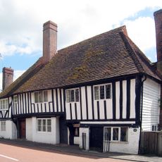
Monk's Cottage, Rother
1.1 km
Abbey Ruins
652 m
The Oast House
1 km
Church Farm And Cottage Church Farm House
77 m
Hill House
1.2 km
Redlands Farmhouse
553 m
Oasthouse, Granary And Cartshed At Redlands Farm To The North West Of The Farmhousee
563 m
The Abbey
611 m
Barn At Park Farmhouse To The South West Of The Farmhouse
1.1 km
Bantony
1.1 km
Barn And Outbuilding At Park Farm To The West Of The Preceding Barn
1.1 km
Park Farmhouse
998 m
The Tomb Of Viscount Milner In The Extension Of St Mary's Churchyard To The North East Of The Church
79 m
The Oasthouse
620 m
23, 24 And 25, Fair Lane
1.1 km
Quaker Cottage
987 m
16, 18 And 20, Northbridge Street
1 km
Bayham
998 m
Keston Cottage
1 km
Church Lane Cottages
117 m
Post Office Terrace Spoutings, Post Office Terrace
48 m
1-5, School Terrace
903 m
Oasthouses And Granary At Moat Farm To The West Of The Farmhouse
848 m
Parsonage Farmhouse
109 m
Oasthouses And Granary At Parsonage Farm To The North Of The House On The North Side Of The Road
191 mRecensioni
Ha visitato questo luogo? Tocchi le stelle per valutarlo e condividere la Sua esperienza o foto con la community! Provalo ora! Puoi annullarlo in qualsiasi momento.
Scopri tesori nascosti ad ogni viaggio!
Da piccoli caffè caratteristici a panorami nascosti, fuggi dalla folla e scova i posti che fanno davvero per te. La nostra app ti semplifica tutto: ricerca vocale, filtri furbi, percorsi ottimizzati e dritte autentiche da viaggiatori di tutto il mondo. Scaricala subito per vivere l'avventura sul tuo smartphone!

Un nuovo approccio alla scoperta turistica❞
— Le Figaro
Tutti i luoghi che meritano di essere esplorati❞
— France Info
Un’escursione su misura in pochi clic❞
— 20 Minutes