
Former Salvation Army Citadel
Former Salvation Army Citadel, architectural structure in Sunderland, Tyne and Wear, UK
Posizione: Sunderland
Coordinate GPS: 54.90818,-1.37959
Ultimo aggiornamento: 25 novembre 2023 alle 01:41
Elephant Tea Rooms
184 m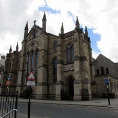
St Mary's Church, Sunderland
199 m
Corder House and Sydenham House
242 m
Empire Cinema
76 m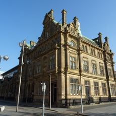
Post Office And Railings
171 m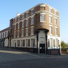
The Bridge Hotel
178 m
Lloyd's Bank And Attached Walls And Gates
243 m
Hutchinson's Buildings
135 m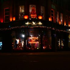
101, 102 And 103, High Street West
153 m
170, 171 And 173, High Street West
207 m
Numbers 45-58 With Steps And Railings Attached
232 m
Borough Social Services Area Office
196 m
211 And 212, High Street West
95 m
Register Buildings
67 m
176, High Street West
191 m
Maritime Buildings And Attached Balustrade
161 m
43-48, West Sunniside
131 m
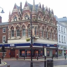
Royal Bank Of Scotland
192 m
Sunniside Chambers
184 m
Frank Doyle's work at Panns Bank, which honours the shipyards
200 m
The Butterflies in High Street West by Frank Styles
167 m
The Midland Bank
215 m
Number 19 And Attached Wall, Railings And Area Cover
229 m
Custom House
113 m
Numbers 28-39 (Consecutive) With Steps And Railings Attached
233 m
Numbers 11-17 With Steps And Railings Attached
240 m
110, 111 And 112, High Street West
113 m
Central Buildings
96 mRecensioni
Ha visitato questo luogo? Tocchi le stelle per valutarlo e condividere la Sua esperienza o foto con la community! Provalo ora! Puoi annullarlo in qualsiasi momento.
Scopri tesori nascosti ad ogni viaggio!
Da piccoli caffè caratteristici a panorami nascosti, fuggi dalla folla e scova i posti che fanno davvero per te. La nostra app ti semplifica tutto: ricerca vocale, filtri furbi, percorsi ottimizzati e dritte autentiche da viaggiatori di tutto il mondo. Scaricala subito per vivere l'avventura sul tuo smartphone!

Un nuovo approccio alla scoperta turistica❞
— Le Figaro
Tutti i luoghi che meritano di essere esplorati❞
— France Info
Un’escursione su misura in pochi clic❞
— 20 Minutes