51 And 53, High Street, building in Mole Valley, Surrey, UK
Posizione: Mole Valley
Coordinate GPS: 51.23201,-0.33230
Ultimo aggiornamento: 21 novembre 2025 alle 00:40
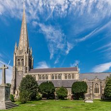
St Martin's Church, Dorking
88 m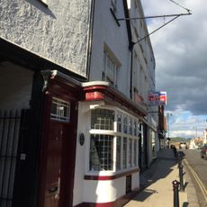
The Wheatsheaf Public House
21 m
100-106, High Street
73 m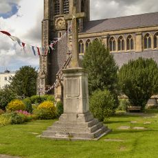
Dorking WWI Memorial Cross
60 m
3 And 11, High Street
61 m
1 and 2, North Street
72 m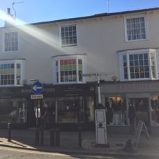
Pump (Before Nos 2 To 6)
81 m
58 And 60, High Street
47 m
13 And 15, High Street
50 m
29 And 31, High Street
30 m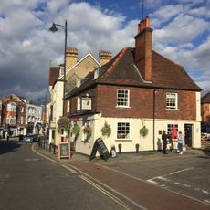
Bull's Head
103 m
1, West Street
101 m
2, West Street
105 m
111 And 113, High Street
80 m
Three Lamp Standards 54 Bollards And Handrail Within Curtilage Of Nos 22 To 100
33 m
Nos 2 To 6 Including Frontage On West Street As Far West As No 1 West Street
89 m
9, South Street
98 m
40-46, High Street
61 m
48-56, High Street
46 m
90-98, High Street
69 m
17 And 19, High Street
48 m
62 And 64, High Street
46 m
41-47, High Street
16 m
8 And 10, South Street
96 m
7, South Street
93 m
10, North Street
86 m
20 and 22, High Street
79 m
John Arthur gallery
61 mRecensioni
Ha visitato questo luogo? Tocchi le stelle per valutarlo e condividere la Sua esperienza o foto con la community! Provalo ora! Puoi annullarlo in qualsiasi momento.
Scopri tesori nascosti ad ogni viaggio!
Da piccoli caffè caratteristici a panorami nascosti, fuggi dalla folla e scova i posti che fanno davvero per te. La nostra app ti semplifica tutto: ricerca vocale, filtri furbi, percorsi ottimizzati e dritte autentiche da viaggiatori di tutto il mondo. Scaricala subito per vivere l'avventura sul tuo smartphone!

Un nuovo approccio alla scoperta turistica❞
— Le Figaro
Tutti i luoghi che meritano di essere esplorati❞
— France Info
Un’escursione su misura in pochi clic❞
— 20 Minutes