47 And 49, West End, building in Kemsing, Sevenoaks, Kent, UK
Posizione: Kemsing
Coordinate GPS: 51.30610,0.22550
Ultimo aggiornamento: 21 novembre 2025 alle 17:33
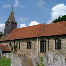
Church of St Mary
395 m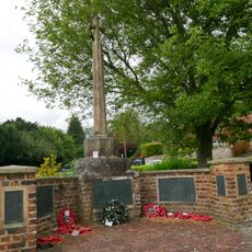
Kemsing War Memorial
275 m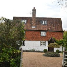
Noah's Ark
1 km
Crowdleham
1.5 km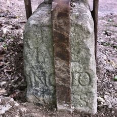
Milestone on Pilgrim's Way
658 m
Guidestone, Pilgrims Way, to W and adjoining track to Kemsing Down Nature Reserve, and jct with Childsbridge Lane
670 m
The Vicarage
420 m
Yew Tree House
327 m
Glen Cottage Gwen's Cottage
363 m
Stones Stores, Foster House
315 m
The St Edith's Hall
367 m
The Keep
284 m
Forecourt Wall To The St Edith's Hall
363 m
Dormer Cottage
236 m
K6 Telephone Kiosk
253 m
Rose Cottage The Well Cottage
287 m
Wybourne Cottages
412 m
Castle Bank
264 m
Wall In Front Of The Box House
238 m
West House
178 m
Barn To South West Of Dyne's Farmhouse
272 m
The Kemsing Heritage Centre
293 m
The Box House
225 m
The Malt House
1.1 km
Wall In Front Of West Part Of Garden Of The Vicarage
400 m
Kemsing Castle Bank
282 m
Punto di vista panoramico
784 m
Punto di vista panoramico
762 mRecensioni
Ha visitato questo luogo? Tocchi le stelle per valutarlo e condividere la Sua esperienza o foto con la community! Provalo ora! Puoi annullarlo in qualsiasi momento.
Scopri tesori nascosti ad ogni viaggio!
Da piccoli caffè caratteristici a panorami nascosti, fuggi dalla folla e scova i posti che fanno davvero per te. La nostra app ti semplifica tutto: ricerca vocale, filtri furbi, percorsi ottimizzati e dritte autentiche da viaggiatori di tutto il mondo. Scaricala subito per vivere l'avventura sul tuo smartphone!

Un nuovo approccio alla scoperta turistica❞
— Le Figaro
Tutti i luoghi che meritano di essere esplorati❞
— France Info
Un’escursione su misura in pochi clic❞
— 20 Minutes