Driving Range
Posizione: Guildford
Coordinate GPS: 51.23897,-0.53531
Ultimo aggiornamento: 21 novembre 2025 alle 14:03
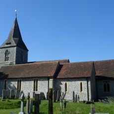
Church of St John the Evangelist
970 m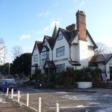
The Horse And Groom Public House
948 m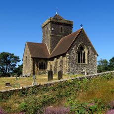
Church of St Martha on the Hill
1.7 km
The Old Cottage
898 m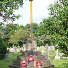
Merrow War Memorial
947 m
Bowl barrow 90m west of Tyting Farm
1.3 km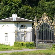
Lodges And Gates To Clandon Park House
1.2 km
Merrow House
1 km
Rockworks And Pond Approximately 80 Metres South West Of Merrow Grange
554 m
The Old Farmhouse
1.1 km
Earth circles on St Martha's Hill
1.7 km
Milestone, Merrow, on east bound dual carriageway
1.6 km
White Lane Farmhouse
1.6 km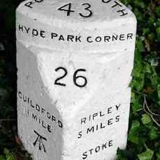
Milestone, London Road, Stoke, at traffic island jct with A25
1.7 km
Former Conservatory, Approximately 10 Metres West Of Merrow Grange
598 m
Vagrants Casual Ward At St Lukes Hospital
1.6 km
Great Goodwin Farm House
1.5 km
Park Farm Cottage
1.5 km
Barn, Approximately 25 Metres West Of Warren Farm House
1 km
Levylsdene House
339 m
Rockwork Grotto, 40 Metres South South West Of Merrow Grange
557 m
Keepers Cottage
943 m
Barn Approximately 100 Metres North Of The Warren
664 m
St Martha's Priory Including The Garage Building, Enclosed Courtyards With Cob Walls And Gateways, Paved Terrace, Retaining Wall And Flight Of Garden Steps
1.6 km
Warren Farm House
1 km
The Cedars
999 m
Evergreen Cottage
1.1 km
Clandon Golf
1.5 kmRecensioni
Ha visitato questo luogo? Tocchi le stelle per valutarlo e condividere la Sua esperienza o foto con la community! Provalo ora! Puoi annullarlo in qualsiasi momento.
Scopri tesori nascosti ad ogni viaggio!
Da piccoli caffè caratteristici a panorami nascosti, fuggi dalla folla e scova i posti che fanno davvero per te. La nostra app ti semplifica tutto: ricerca vocale, filtri furbi, percorsi ottimizzati e dritte autentiche da viaggiatori di tutto il mondo. Scaricala subito per vivere l'avventura sul tuo smartphone!

Un nuovo approccio alla scoperta turistica❞
— Le Figaro
Tutti i luoghi che meritano di essere esplorati❞
— France Info
Un’escursione su misura in pochi clic❞
— 20 Minutes