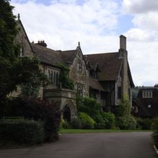
The Abbey, Storrington
2.3 km
Prehistoric flint mine and a Martin Down style enclosure on Harrow hill, 850m south east of Lee Farm
2.3 km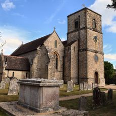
The Parish Church of St Mary the Virgin
2.4 km
Church of St Peter, Parham
2.4 km
Pair of platform barrows on the western side of Kithurst Hill car park: part of a dispersed round barrow cemetery on Kithurst Hi
520 m
Rising Sun Cottage
2.5 km
Storrington War Memorial
2.4 km
Rackham Banks: A cross dyke and Itford Hill style settlement on Rackham Hill, 900m SSE of Oldbottom Barn
2.2 km
Ladye Place
2.5 km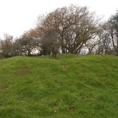
Bowl barrow on Springhead Hill, 750m SSW of Springhead Farm
1.4 km
Bowl barrow at Kithurst Hill car park: part of a dispersed round barrow cemetery on Kithurst Hill
444 m
Linear group of three bowl barrows immediately east of Kithurst Hill car park: part of a dispersed round barrow cemetery on Kith
402 m
Group of four bowl barrows at the Chantry Post
1.5 km
Bowl barrow 950m south west of Grey Friars Farm: part of a dispersed round barrow cemetery on Kithurst Hill
609 m
Cross dyke on Chantry Hill, 470m south of Grey Friars Farm
1.3 km
Group of six bowl barrows 790m south west of Grey Friars Farm: part of a dispersed round barrow cemetery on Kithurst Hill
770 m
Abbey Convent
2.3 km
Cobb Court
2.2 km
Waterfall Cottage
2.2 km
Pair Of Cottages And Attached Wall At St Joseph's Hall
2.1 km
St Josephs Hall
2.1 km
Rod Cottage
2.2 km
Prehistoric linear boundary on Wepham Down
2.4 km
The Horsecroft
2.4 km
An unenclosed Iron Age urnfield and associated remains on Rackham Hill, 900m SSE of Rackham Farm
2 km
Cootham House
2 km
Springhead Farmhouse
1.7 km
Cross dyke on Springhead Hill, 780m south of Springhead Farm
1.2 kmRecensioni
Ha visitato questo luogo? Tocchi le stelle per valutarlo e condividere la Sua esperienza o foto con la community! Provalo ora! Puoi annullarlo in qualsiasi momento.
Scopri tesori nascosti ad ogni viaggio!
Da piccoli caffè caratteristici a panorami nascosti, fuggi dalla folla e scova i posti che fanno davvero per te. La nostra app ti semplifica tutto: ricerca vocale, filtri furbi, percorsi ottimizzati e dritte autentiche da viaggiatori di tutto il mondo. Scaricala subito per vivere l'avventura sul tuo smartphone!

Un nuovo approccio alla scoperta turistica❞
— Le Figaro
Tutti i luoghi che meritano di essere esplorati❞
— France Info
Un’escursione su misura in pochi clic❞
— 20 Minutes