
Maxův javor u Kozího potoka, memorable tree in Karlovy Vary District, Czech Republic
Posizione: Potůčky
Altezza: 20 m
Coordinate GPS: 50.42016,12.74131
Ultimo aggiornamento: 6 marzo 2025 alle 13:13

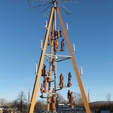
Christmas Pyramid
2.4 km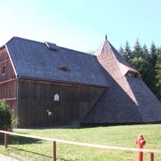
Pferdegöpel Johanngeorgenstadt
2.5 km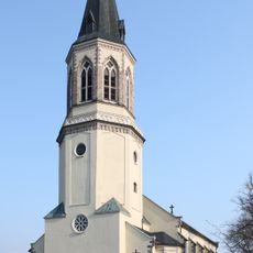
Stadtkirche Johanngeorgenstadt
1.2 km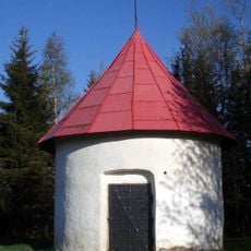
Pulverturm
2.8 km
Na strašidlech
2.2 km
Elias
3 km
Weiße Taube Stolln
1.5 km
Katharina
3 km
Malzmühle Johanngeorgenstadt
892 m
Mittleres Blaufarbenwerk
1.7 km
Chapel of Saint Michael
2.7 km
Felshaus
2.9 km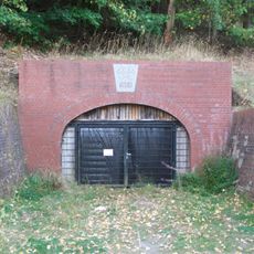
Neujahr-Stolln
1.3 km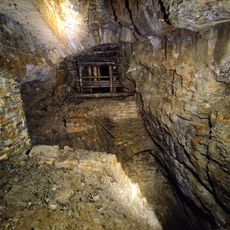
Schaubergwerk Glöckl
1.2 km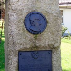
Gedenkstein Bergmeister Fischer
2.5 km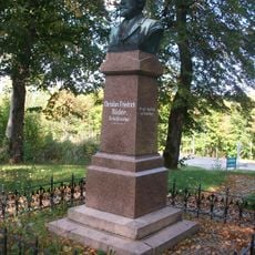
Christian-Friedrich-Röder-Denkmal Johanngeorgenstadt
1.4 km
Nepomuksäule
1.7 km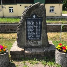
Denkmal für die Gefallenen des Ersten Weltkrieges Wittigsthalstraße 19 21 (vor)
1.2 km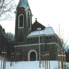
Church of the Visitation of Our Lady
960 m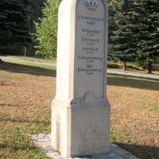
Kgl.-sächs. Postmeilenstein Johanngeorgenstadt
1.3 km
Frisch Glück Fundgrube
1.2 km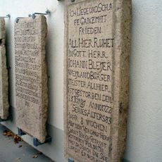
Cemetery Johanngeorgenstadt
1.1 km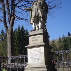
Johann Georg I.-Denkmal in Johanngeorgenstadt
1.3 km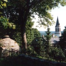
Sachgesamtheit Friedhof Johanngeorgenstadt Hospitalstraße -
1.1 km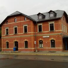
Bahnhof Johanngeorgenstadt
2.1 km
Gotthelf-Schaller-Tageschacht
2.8 km
Zoll- und Grenzhaus Wittigsthalstraße 14
1.2 km
Gabe-Gottes-Fundgrube
2.3 kmRecensioni
Ha visitato questo luogo? Tocchi le stelle per valutarlo e condividere la Sua esperienza o foto con la community! Provalo ora! Puoi annullarlo in qualsiasi momento.
Scopri tesori nascosti ad ogni viaggio!
Da piccoli caffè caratteristici a panorami nascosti, fuggi dalla folla e scova i posti che fanno davvero per te. La nostra app ti semplifica tutto: ricerca vocale, filtri furbi, percorsi ottimizzati e dritte autentiche da viaggiatori di tutto il mondo. Scaricala subito per vivere l'avventura sul tuo smartphone!

Un nuovo approccio alla scoperta turistica❞
— Le Figaro
Tutti i luoghi che meritano di essere esplorati❞
— France Info
Un’escursione su misura in pochi clic❞
— 20 Minutes