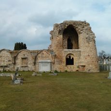
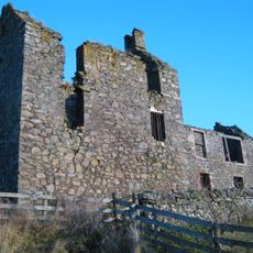
Torwoodlee Broch, Fortezza dell'Età del Ferro a Caddonfoot, Scozia.
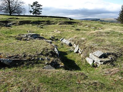
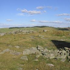
Torwoodlee Broch è una fortezza circolare in pietra con diametro di circa 23 metri e muri spessi circa 5,5 metri. L'ingresso era posizionato per ripararsi dai venti occidentali, e l'interno conteneva diverse camere, inclusa una sala di guardia vicino all'ingresso.
La fortezza risale all'Età del ferro e fu successivamente utilizzata dai Romani durante il 1° secolo d.C. Gli scavi archeologici nel 1891 hanno rivelato oggetti romani come ceramica, vetro e una moneta dell'imperatore Tito.
Il nome riflette gli antichi boschi che un tempo coprivano questa area. I visitatori possono ancora avvertire come il terreno circostante ha influenzato il modo in cui le persone si insediarono qui.
Il sito appare come resti di pietra bassi oggi poiché i muri si innalzano meno di 0,5 metri di altezza. Indossa scarpe robuste perché il terreno è collinare e le grandi pietre sono irregolari.
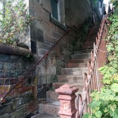
Una camera interna vicino all'ingresso serviva come posto di guardia per controllare l'accesso alla fortezza. Notevolmente, una camera separata conteneva i resti di un'antica scala che conduceva a livelli superiori all'interno della struttura.
La comunità dei viaggiatori curiosi
AroundUs riunisce migliaia di luoghi selezionati, consigli locali e gemme nascoste, arricchiti ogni giorno da oltre 60,000 contributori in tutto il mondo.