Eylesbarrow mine

Accedi al tuo account

AroundUs è una mappa collaborativa di luoghi interessanti, costruita da esploratori curiosi come te. Cresce con ogni recensione, storia e foto che condividi.
Accedi per salvare i tuoi posti preferiti, contribuire con nuovi luoghi e creare percorsi personalizzati.
Continua con Google
Continua con Apple
Continua con X
Continua con Facebook
Continua con email
Continuando, accetti i nostri Termini e Condizioni e la nostra Informativa sulla Privacy
Creare un account
Aggiungi alla collezione
Mappa
Suggerisci una modifica
Condividere

Eylesbarrow mine, Miniera di stagno nella foresta di Dartmoor, Inghilterra.

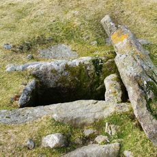
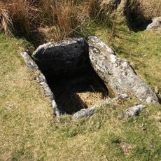
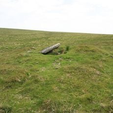
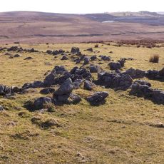
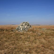
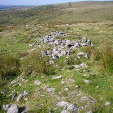
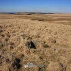
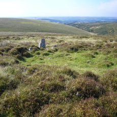
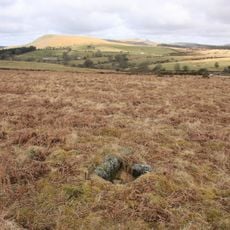
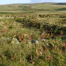
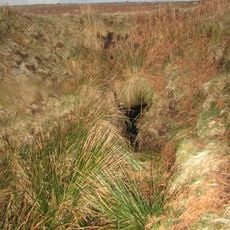
La miniera di Eylesbarrow è un sito di estrazione di stagno nella foresta di Dartmoor con più teste di pozzo visibili come fosse coniche sparse sul terreno. L'apertura più grande misura circa 16 metri di diametro e spicca chiaramente tra le altre.

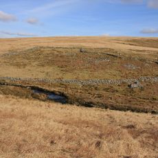
La miniera funzionava durante la prima metà del 19esimo secolo e raggiunse il suo picco di attività intorno al 1825. Questo periodo segnò un'epoca di intensa attività mineraria in tutta la regione di Dartmoor.

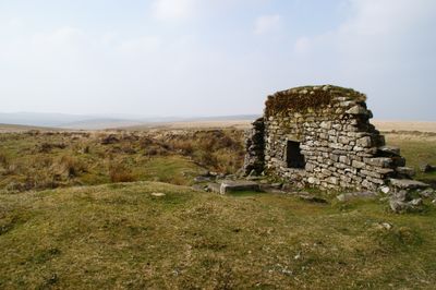
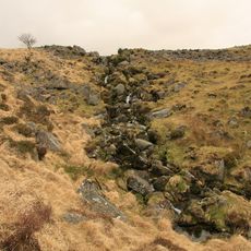
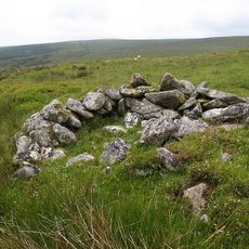
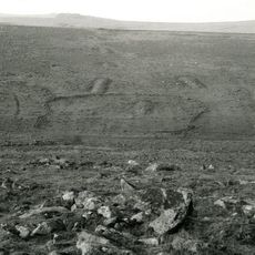
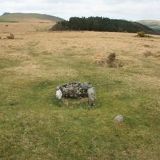
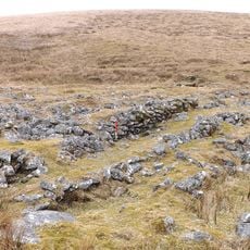
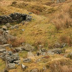
I resti dei mulini di compressione e delle fonderie mostrano come i minatori organizzavano il loro lavoro sul terreno. Il modo in cui l'acqua veniva incanalata attraverso il sito riflette come le persone si adattavano al paesaggio per alimentare le loro operazioni.

Il sito si trova a nord del fiume Plym ed è raggiungibile tramite sentieri rurali che collegano i villaggi vicini. Indossate scarpe resistenti e portate abbigliamento appropriato alle condizioni meteorologiche, poiché il terreno è irregolare e le condizioni possono cambiare rapidamente.

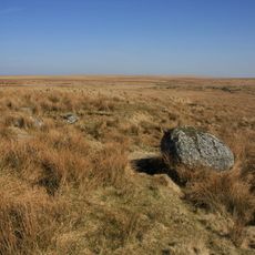
I giacimenti di minerale sono stati plasmati da processi geologici che hanno spinto vene di stagno verticali attraverso la roccia granitica sottostante. Queste formazioni naturali determinavano dove e come i minatori potevano estrarre il loro materiale.

Posizione: Shaugh Prior

Posizione: Sheepstor

Posizione: Dartmoor Forest

Coordinate GPS: 50.48000,-3.97000

Ultimo aggiornamento: 12 dicembre 2025 alle 15:26

Foto
Intorno a questo luogo
Ditsworthy Warren House
Regno Unito

Ditsworthy Warren House

1.9 km
Drizzlecombe
Regno Unito

Drizzlecombe

1.4 km
Yellowmead Down
Regno Unito

Yellowmead Down

3.2 km
Duck's Pool, Dartmoor
Regno Unito

Duck's Pool, Dartmoor

2.5 km
Grim's Grave cairn with a cist, Langcombe
Regno Unito

Grim's Grave cairn with a cist, Langcombe

921 m
Yealm Steps
Regno Unito

Yealm Steps

3 km
Double stone alignment with a terminal stone setting south of Great Trowlesworthy Tor
Regno Unito

Double stone alignment with a terminal stone setting south of Great Trowlesworthy Tor

3.6 km
Platform cairn and cist 80m south east of Calveslake Tor
Regno Unito

Platform cairn and cist 80m south east of Calveslake Tor

1.3 km
Cist 430m ESE of Yealm Steps
Regno Unito

Cist 430m ESE of Yealm Steps

3.3 km
Partially enclosed stone hut circle settlement and post-medieval warren structures on the western slope of Little and Great Trow
Regno Unito

Partially enclosed stone hut circle settlement and post-medieval warren structures on the western slope of Little and Great Trow

3.4 km
Round cairn on the summit of Great Gnat's Head
Regno Unito

Round cairn on the summit of Great Gnat's Head

2.1 km
Prehistoric settlement, three round cairns and a post-medieval rabbit warren at Legis Tor
Regno Unito

Prehistoric settlement, three round cairns and a post-medieval rabbit warren at Legis Tor

3.1 km
Five stone hut circles 320m east of Yealm Steps forming part of a large stone hut circle settlement
Regno Unito

Five stone hut circles 320m east of Yealm Steps forming part of a large stone hut circle settlement

3.1 km
Multi-period remains at Hentor Warren
Regno Unito

Multi-period remains at Hentor Warren

1.5 km
Cairn with a cist south-east of Shavercombe Tor
Regno Unito

Cairn with a cist south-east of Shavercombe Tor

851 m
Prehistoric stone hut circle settlement, a contemporary field system, post-medieval buildings and two lengths of leat 310m south
Regno Unito

Prehistoric stone hut circle settlement, a contemporary field system, post-medieval buildings and two lengths of leat 310m south

3.3 km
Cairn with cist north of Gutter Tor
Regno Unito

Cairn with cist north of Gutter Tor

2.8 km
Cairn with a cist east of Willings Walls Reave
Regno Unito

Cairn with a cist east of Willings Walls Reave

2.3 km
One of several cairns with cists south of Langcombe Brook
Regno Unito

One of several cairns with cists south of Langcombe Brook

921 m
Cist south east of Roughtor Plantation
Regno Unito

Cist south east of Roughtor Plantation

3 km
Hut circles in Erme Pound E of River Erme
Regno Unito

Hut circles in Erme Pound E of River Erme

3.5 km
Agglomerated enclosure with hut circles and later farmstead at Whittenknowles Rocks
Regno Unito

Agglomerated enclosure with hut circles and later farmstead at Whittenknowles Rocks

1.9 km
Cairn with a cist north of Whittenknowles Rocks
Regno Unito

Cairn with a cist north of Whittenknowles Rocks

2.2 km
Yellowmead stone circles, cairn and stone alignment
Regno Unito

Yellowmead stone circles, cairn and stone alignment

3.2 km
Foxton Cross
Regno Unito

Foxton Cross

3.3 km
A prehistoric settlement with cairns and a historic tin mill, streamwork and buildings lying adjacent to the Langcombe Brook
Regno Unito

A prehistoric settlement with cairns and a historic tin mill, streamwork and buildings lying adjacent to the Langcombe Brook

680 m
Blowing house N of Yealm Steps
Regno Unito

Blowing house N of Yealm Steps

2.8 km
Two Brothers Adit
Regno Unito

Two Brothers Adit

2.2 km
Mostra la mappa completa
Recensioni

Ha visitato questo luogo? Tocchi le stelle per valutarlo e condividere la Sua esperienza o foto con la community! Provalo ora! Puoi annullarlo in qualsiasi momento.

« Eylesbarrow mine - Miniera di stagno nella foresta di Dartmoor, Inghilterra » è fornito da Around Us (it.aroundus.com). Le immagini e i testi sono tratti dal progetto Wikimedia con licenza Creative Commons. È possibile copiare, distribuire e modificare copie di questa pagina, alle condizioni stabilite dalla licenza, a condizione che questa nota sia chiaramente visibile.

Scopri tesori nascosti ad ogni viaggio!

Da piccoli caffè caratteristici a panorami nascosti, fuggi dalla folla e scova i posti che fanno davvero per te. La nostra app ti semplifica tutto: ricerca vocale, filtri furbi, percorsi ottimizzati e dritte autentiche da viaggiatori di tutto il mondo. Scaricala subito per vivere l'avventura sul tuo smartphone!

Around Us App Screenshot

Un nuovo approccio alla scoperta turistica

Le Figaro

Tutti i luoghi che meritano di essere esplorati

France Info

Un’escursione su misura in pochi clic

20 Minutes