WWT Martin Mere

Accedi al tuo account

AroundUs è una mappa collaborativa di luoghi interessanti, costruita da esploratori curiosi come te. Cresce con ogni recensione, storia e foto che condividi.
Accedi per salvare i tuoi posti preferiti, contribuire con nuovi luoghi e creare percorsi personalizzati.
Continuando, accetti i nostri Termini e Condizioni e la nostra Informativa sulla Privacy

WWT Martin Mere, Riserva naturale nel West Lancashire, Inghilterra
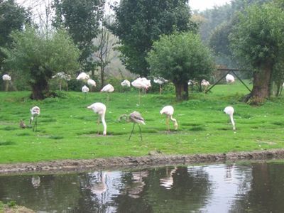
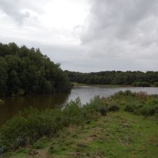
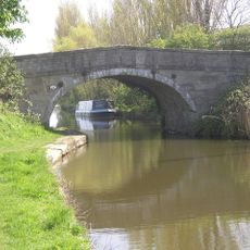
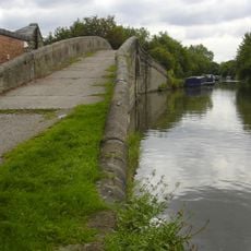
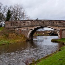
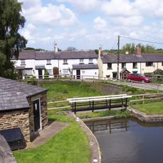
Martin Mere comprende 100 ettari di zone umide con numerosi specchi d'acqua, sentieri e punti di osservazione per la fauna selvatica.

Il centro delle zone umide ha aperto nel 1975 nell'ambito di iniziative per ripristinare gli habitat naturali e proteggere le specie del Lancashire.

La riserva gestisce programmi educativi sugli ecosistemi delle zone umide, offrendo informazioni sul rapporto tra acqua, terra e fauna selvatica.

Situata a 20 minuti dall'autostrada M6, la riserva offre parcheggio gratuito, dodici capanni per l'osservazione degli uccelli e sentieri accessibili.

Durante le migrazioni invernali, migliaia di oche zamperose e cigni selvatici si radunano a Martin Mere, creando grandi concentrazioni di uccelli acquatici.

Posizione: West Lancashire

Inizio: 1975

Sito web: https://wwt.org.uk/wetland-centres/martin-mere

Coordinate GPS: 53.62300,-2.86900

Ultimo aggiornamento: 16 marzo 2025 alle 13:34

Intorno a questo luogo
Mostra la mappa completa
Rufford Old Hall
Regno Unito

Rufford Old Hall

4 km
Scarisbrick Hall
Regno Unito

Scarisbrick Hall

3.9 km
Blythe Hall, Lathom
Regno Unito

Blythe Hall, Lathom

4.6 km
Burscough Priory
Regno Unito

Burscough Priory

4.5 km
Rufford New Hall
Regno Unito

Rufford New Hall

3.6 km
Mere Sands Wood
Regno Unito

Mere Sands Wood

2.5 km
St John's Church, Burscough
Regno Unito

St John's Church, Burscough

2.8 km
St Mark's Church, Scarisbrick
Regno Unito

St Mark's Church, Scarisbrick

4.8 km
Church of St Mary the Virgin, Rufford
Regno Unito

Church of St Mary the Virgin, Rufford

4 km
Roman Catholic Church of St Elizabeth
Regno Unito

Roman Catholic Church of St Elizabeth

3.6 km
Bath Lodge
Regno Unito

Bath Lodge

5.2 km
Moss Bridge
Regno Unito

Moss Bridge

5.2 km
Martin Lane Bridge
Regno Unito

Martin Lane Bridge

2.4 km
Junction Bridge At Top Locks (That Part In Lathom)  Leeds And Liverpool Canal Junction Bridge At Top Locks (That Part In Burscough)
Regno Unito

Junction Bridge At Top Locks (That Part In Lathom) Leeds And Liverpool Canal Junction Bridge At Top Locks (That Part In Burscough)

3.8 km
Runnel Brow Bridge (That Part In Burscough)  Runnel Brow Bridge (That Part In Lathom)
Regno Unito

Runnel Brow Bridge (That Part In Burscough) Runnel Brow Bridge (That Part In Lathom)

3.7 km
Cottage, coach house and stables, Rufford Old Hall
Regno Unito

Cottage, coach house and stables, Rufford Old Hall

4.1 km
North Lodge To Scarisbrick Hall With Gatepiers And Walling
Regno Unito

North Lodge To Scarisbrick Hall With Gatepiers And Walling

3.5 km
Lathom and Burscough War Memorial
Regno Unito

Lathom and Burscough War Memorial

3.1 km
Leeds And Liverpool Canal Top Locks, Upper Lock (That Part In Burscough)  Top Locks, Upper Lock (That Part In Lathom)
Regno Unito

Leeds And Liverpool Canal Top Locks, Upper Lock (That Part In Burscough) Top Locks, Upper Lock (That Part In Lathom)

3.8 km
Junction Bridge Canal Basin And Former Dry Dock, Top Locks (That Part In Lathom)  Leeds And Liverpool Canal Junction Bridge Canal Basin And Former Dry Dock, Top Locks (That Part In Burscough)
Regno Unito

Junction Bridge Canal Basin And Former Dry Dock, Top Locks (That Part In Lathom) Leeds And Liverpool Canal Junction Bridge Canal Basin And Former Dry Dock, Top Locks (That Part In Burscough)

3.8 km
K6 Telephone Kiosk At Junction With Southport Road
Regno Unito

K6 Telephone Kiosk At Junction With Southport Road

4.6 km
Hurlston Gate Farmhouse
Regno Unito

Hurlston Gate Farmhouse

5 km
Barn Circa 100 Metres South West Of Drummersdale Lane
Regno Unito

Barn Circa 100 Metres South West Of Drummersdale Lane

2.4 km
Briars Brook Culvert
Regno Unito

Briars Brook Culvert

4.2 km
Burscough Bridge Railway Station Building On North Side Of Track
Regno Unito

Burscough Bridge Railway Station Building On North Side Of Track

2.7 km
Railway Bridge Over Leeds And Liverpool Canal At Ainscough's Mill
Regno Unito

Railway Bridge Over Leeds And Liverpool Canal At Ainscough's Mill

3.3 km
Canal Lock Approximately 50 Metres North Of Runnel Brow Bridge (That Part In Burscough)  Canal Lock Approximately 50 Metres North Of Runnel Brow Bridge (That Part In Lathom)
Regno Unito

Canal Lock Approximately 50 Metres North Of Runnel Brow Bridge (That Part In Burscough) Canal Lock Approximately 50 Metres North Of Runnel Brow Bridge (That Part In Lathom)

3.7 km
Scarisbrick Park wayside cross
Regno Unito

Scarisbrick Park wayside cross

4.5 km
Mostra la mappa completa

Recensioni

Ha visitato questo luogo? Tocchi le stelle per valutarlo e condividere la Sua esperienza o foto con la community! Provalo ora! Puoi annullarlo in qualsiasi momento.

« WWT Martin Mere - Riserva naturale nel West Lancashire, Inghilterra » è fornito da Around Us (it.aroundus.com). Le immagini e i testi sono tratti dal progetto Wikimedia con licenza Creative Commons. È possibile copiare, distribuire e modificare copie di questa pagina, alle condizioni stabilite dalla licenza, a condizione che questa nota sia chiaramente visibile.

Scopri tesori nascosti ad ogni viaggio!

Da piccoli caffè caratteristici a panorami nascosti, fuggi dalla folla e scova i posti che fanno davvero per te. La nostra app ti semplifica tutto: ricerca vocale, filtri furbi, percorsi ottimizzati e dritte autentiche da viaggiatori di tutto il mondo. Scaricala subito per vivere l'avventura sul tuo smartphone!

Around Us App Screenshot

Un nuovo approccio alla scoperta turistica

Le Figaro

Tutti i luoghi che meritano di essere esplorati

France Info

Un’escursione su misura in pochi clic

20 Minutes