
Bowyer's Farmhouse, farmhouse in Swallowfield, Wokingham, Berkshire, UK
Posizione: Swallowfield
Coordinate GPS: 51.37733,-0.96043
Ultimo aggiornamento: 15 novembre 2025 alle 14:24
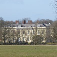
Swallowfield Park
1 km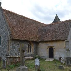
Church of All Saints
722 m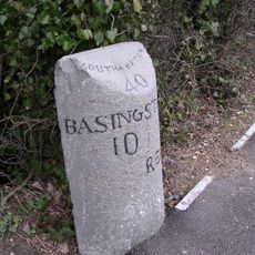
Milestone
1 km
Wyvols Court
346 m
Girdlers
456 m
Clythers
1.2 km
Swallowfield Cottage The Old Post House
306 m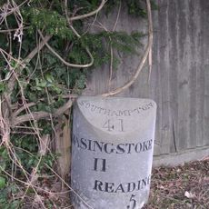
Milestone North North West Of Sheep Bridge
714 m
Sheepbridge Court
858 m
Moated site at Sheepbridge Court
728 m
Angel Sprints
988 m
Queen Anne's Mead
733 m
Walls And Piers To The Red Lodge
361 m
Riseley Farmhouse
1.2 km
The Garden Gate And Walls Approximately 75 Metres North West Of The Stable Block To Swallowfield Park
937 m
George And Dragon
1.2 km
Pittman Tomb, Approximately 7 Metres North Of The Transept Of The Church Of All Saints
724 m
Goddard's Farmhouse
803 m
The Red Lodge
361 m
Bridge Over The River Blackwater At Swallowfield Park
540 m
Barn Approximately 80 Metres North Of Sheepbridge Court
820 m
Tomb Approximately 11 Metres North East Of Chancel Of The Church Of All Saints
742 m
Dovecote House, Swallowfield Park
874 m
Village Farmhouse
301 m
Barn Adjacent To Goddard's Farmhouse On The North
792 m
The Poors House
856 m
Dovecote, Swallowfield Park
897 m
Icehouse In Swallowfield Park Approximately 420 Metres South East From House
925 mRecensioni
Ha visitato questo luogo? Tocchi le stelle per valutarlo e condividere la Sua esperienza o foto con la community! Provalo ora! Puoi annullarlo in qualsiasi momento.
Scopri tesori nascosti ad ogni viaggio!
Da piccoli caffè caratteristici a panorami nascosti, fuggi dalla folla e scova i posti che fanno davvero per te. La nostra app ti semplifica tutto: ricerca vocale, filtri furbi, percorsi ottimizzati e dritte autentiche da viaggiatori di tutto il mondo. Scaricala subito per vivere l'avventura sul tuo smartphone!

Un nuovo approccio alla scoperta turistica❞
— Le Figaro
Tutti i luoghi che meritano di essere esplorati❞
— France Info
Un’escursione su misura in pochi clic❞
— 20 Minutes