
Ehem. Kurhaus, building in Fürstenzell, Lower Bavaria, Germany
Posizione: Fürstenzell
Indirizzo: Bad Höhenstadt 123
Coordinate GPS: 48.49974,13.31485
Ultimo aggiornamento: 25 novembre 2023 alle 00:44
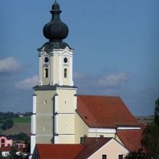
Mariä Himmelfahrt
354 m
Kleine Wegkapelle
396 m
Kapelle
707 m
Kapelle
542 m
Cultural heritage D-2-7545-0079 in Ruhstorf an der Rott
1.6 km
Cultural heritage D-2-7445-0001 in Fürstenzell
969 m
Bedürfnisanstalt Obersulzbach 10 in Fürstenzell
795 m
Bauernhaus
865 m
Cultural heritage D-2-7545-0149 in Fürstenzell
356 m
Güterschuppen Obersulzbach 10 in Fürstenzell
824 m
Pfarrhaus
280 m
Hauskapelle und Bibliothek
776 m
Bildstock
712 m
Einfirsthof
1.8 km
Cultural heritage D-2-7445-0052 in Fürstenzell
1.4 km
Bauernhaus Munzing 2 in Fürstenzell
869 m
Stallstadel
881 m
Kornspeicher Munzing 2 in Fürstenzell
891 m
Zugehöriger Traidkasten und Durchfahrt
1.8 km
Friedhofsmauer Bad Höhenstadt 21 in Fürstenzell
356 m
Bahnhof Bad Höhenstadt
811 m
Zugehöriger Traidkasten
1.6 km
Hofkreuz-Reut
1.3 km
Marokkaner-Kreuz
1 km
Croce votiva
1.4 km
Croce votiva
1.6 km
Moorbad
352 m
Löwenbrunnen
313 mRecensioni
Ha visitato questo luogo? Tocchi le stelle per valutarlo e condividere la Sua esperienza o foto con la community! Provalo ora! Puoi annullarlo in qualsiasi momento.
Scopri tesori nascosti ad ogni viaggio!
Da piccoli caffè caratteristici a panorami nascosti, fuggi dalla folla e scova i posti che fanno davvero per te. La nostra app ti semplifica tutto: ricerca vocale, filtri furbi, percorsi ottimizzati e dritte autentiche da viaggiatori di tutto il mondo. Scaricala subito per vivere l'avventura sul tuo smartphone!

Un nuovo approccio alla scoperta turistica❞
— Le Figaro
Tutti i luoghi che meritano di essere esplorati❞
— France Info
Un’escursione su misura in pochi clic❞
— 20 Minutes