
Outbuilding Attached To West Of East Langton Farmhouse
Outbuilding Attached To West Of East Langton Farmhouse, appendage in Langton, County Durham, UK
Posizione: Langton
Coordinate GPS: 54.56978,-1.73525
Ultimo aggiornamento: 15 novembre 2025 alle 22:45
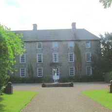
Headlam Hall
971 m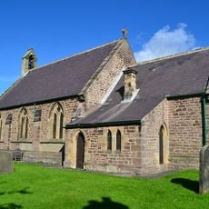
Church of St John the Evangelist
1.1 km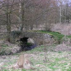
Packhorse bridge
851 m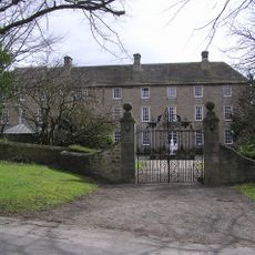
Gate Piers And Walls, 20 Metres North-West Of Headlam Hall
937 m
7 And 8, The Green
859 m
Stable Block, 15 Metres North Of The Garth
794 m
Startforth
1.1 km
Greencroft
1.1 km
Holbeck Farmhouse
1.1 km
Ingleton Grange
1.8 km
Boxwood
1.2 km
Killerby Hall
2 km
Dovecote,120 Metres North Of Headlam Hall
977 m
The Garth
802 m
Walled Garden Adjoining To North Of Hill House
1.9 km
The Poplars And Vine House
1.1 km
Hill House
1.9 km
Old Farmhouse At Hollin Hall West
1.2 km
Cartshed And Barn, 10 Metres West Of Old Farmhouse, Hollin Hall West
1.3 km
Pound, 50 Metres North Of The Pack-Horse Bridge
811 m
East Langton Farmhouse
31 m
Smithy, Byres And Dovecote, 12 Metres East Of Hill House
1.9 km
The Cottage
1.1 km
Raysholme
1.1 km
Copper Beech House And Attached Outbuildings
265 m
Stable And Loose Boxes Attached To Old Farmhouse, Hollin Hall West
1.3 km
Dovecote At Killerby Grange
2 km
Milestone, 80 Metres South Of Killerby Garths
1.8 kmRecensioni
Ha visitato questo luogo? Tocchi le stelle per valutarlo e condividere la Sua esperienza o foto con la community! Provalo ora! Puoi annullarlo in qualsiasi momento.
Scopri tesori nascosti ad ogni viaggio!
Da piccoli caffè caratteristici a panorami nascosti, fuggi dalla folla e scova i posti che fanno davvero per te. La nostra app ti semplifica tutto: ricerca vocale, filtri furbi, percorsi ottimizzati e dritte autentiche da viaggiatori di tutto il mondo. Scaricala subito per vivere l'avventura sul tuo smartphone!

Un nuovo approccio alla scoperta turistica❞
— Le Figaro
Tutti i luoghi che meritano di essere esplorati❞
— France Info
Un’escursione su misura in pochi clic❞
— 20 Minutes