
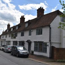
Walters Farmhouse, farmhouse in Brenchley, Tunbridge Wells, Kent, UK
Posizione: Brenchley and Matfield
Coordinate GPS: 51.15140,0.39741
Ultimo aggiornamento: 25 novembre 2023 alle 01:29
The Rose And Crown Public House
115 m
The Old Palace
157 m
The Old Workhouse
16 m
Terry's Town Farm Cottage Town Farmhouse
229 m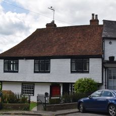
The Old Vicarage
193 m
South Cottage
188 m
Church House
200 m
Park Cottage
69 m
Bournes Shop And House Adjoining At The West
127 m
The Cottage South East Of Portobello Including Walls To The Garden East Of Portobello
68 m
The White House
162 m
The Bull Public House
179 m
Little Portobello Including Garden Railings To The West
181 m
Portobello
54 m
Garden Walls And Railings West And South Of Portobello Including Pedestrian Gate And Piers To Carriage Gate
44 m
Hill House
196 m
Barn About 20 Metres East Of Portobello
93 m
The Drinking Fountain
211 m
John Hanbury Headstone About 23 Metres North West Of The Tower Of The Church Of All Saints
211 m
Little Broad Oak Including Railings And Gate To Garden To The West And Brick Walls To Garden To The East
212 m
Lychgate and Churchyard Walls to the Parish Church of All Saints
218 m
2 Chest Tombs About 9 Metres South East Of The Porch Of The Church Of All Saints
225 m
3 Wimshurst Headstones And 5 Bodystones About 10 Metres South East Of The Porch Of The Church Of All Saints
226 m
Marchant Chest Tomb And Railings About 19 Metres North Of The Church Porch, West Side Of The Path
228 m
The War Memorial
30 m
Row Of 5 Diamond Headstones, 6 Footstones And 2 Bodystones About 10 Metres West Of The West Door Of The Church Of All Saints
230 m
Marchant Chest Tomb And Railings About 13 Metres North Of The Church Porch, West Side Of The Path Of The Church Of All Saints
231 m
Pair Of Prall Headstones About 5 Metres North Of The Tower Of The Church Of All Saints
234 mRecensioni
Ha visitato questo luogo? Tocchi le stelle per valutarlo e condividere la Sua esperienza o foto con la community! Provalo ora! Puoi annullarlo in qualsiasi momento.
Scopri tesori nascosti ad ogni viaggio!
Da piccoli caffè caratteristici a panorami nascosti, fuggi dalla folla e scova i posti che fanno davvero per te. La nostra app ti semplifica tutto: ricerca vocale, filtri furbi, percorsi ottimizzati e dritte autentiche da viaggiatori di tutto il mondo. Scaricala subito per vivere l'avventura sul tuo smartphone!

Un nuovo approccio alla scoperta turistica❞
— Le Figaro
Tutti i luoghi che meritano di essere esplorati❞
— France Info
Un’escursione su misura in pochi clic❞
— 20 Minutes