
222 And 224, Butchers Lane, building in Mereworth, Tonbridge and Malling, Kent, UK
Posizione: Mereworth
Coordinate GPS: 51.26733,0.37694
Ultimo aggiornamento: 25 novembre 2023 alle 01:30
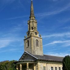
St Lawrence's Church, Mereworth
951 m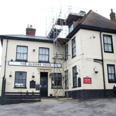
The Queens Head Public House
406 m
Herne Cottage
492 m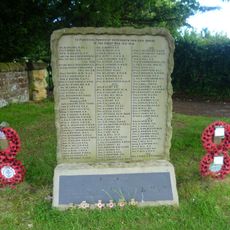
Mereworth War Memorial
952 m
183, Butchers Lane
23 m
The Rectory
1.3 km
Farm Building 20 Yards South West Of The Queens Head Public House
420 m
Childeric Cottage Childeric House
1.1 km
Springfield
1.1 km
91, The Street
1 km
196 And 198, Butchers Lane
163 m
137-139, The Street
924 m
276 And 278, The Street
971 m
The Cross
946 m
Highlands House
627 m
95, The Street
997 m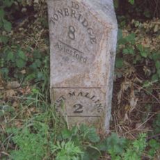
Milestone, Malling Road, N of crossroads with Kent Street, by entrance to log company(Kate Reed Wood)
703 m
Rose Cottage
27 m
Moorcocks Farmhouse
684 m
Black Lion House
1.1 km
Barn 20 Yards To The West Of Barons Place Farm
992 m
The Malt House
887 m
Libbits Cottages
1.1 km
Brewers Hall Farmhouse
1.2 km
Gibson Building
1.3 km
Holly Cottage
90 m
Garages To Rear Of Gibson Building (Tonbridge And Malling Borough Council Offices, Former Officers Mess)
1.3 km
Buildings 10, 20, 30, 50, 60 And 70 Former Barracks
1.4 kmRecensioni
Ha visitato questo luogo? Tocchi le stelle per valutarlo e condividere la Sua esperienza o foto con la community! Provalo ora! Puoi annullarlo in qualsiasi momento.
Scopri tesori nascosti ad ogni viaggio!
Da piccoli caffè caratteristici a panorami nascosti, fuggi dalla folla e scova i posti che fanno davvero per te. La nostra app ti semplifica tutto: ricerca vocale, filtri furbi, percorsi ottimizzati e dritte autentiche da viaggiatori di tutto il mondo. Scaricala subito per vivere l'avventura sul tuo smartphone!

Un nuovo approccio alla scoperta turistica❞
— Le Figaro
Tutti i luoghi che meritano di essere esplorati❞
— France Info
Un’escursione su misura in pochi clic❞
— 20 Minutes