
Brook Farmhouse, farmhouse in Frittenden, Tunbridge Wells, Kent, UK
Posizione: Frittenden
Coordinate GPS: 51.14307,0.58572
Ultimo aggiornamento: 25 novembre 2023 alle 01:31

Church of St Mary
554 m
Monument To Reverend Edward Moore, About 25 Metres South Of Church Of St Mary
581 m
Charity Cottages
612 m
Well And Housing About 10 Metres East Of Well House
606 m
Frittenden War Memorial
668 m
Frittenden Stores Manchester House
583 m
Wall And Outhouse Attached To Well House
605 m
Forge House
610 m
Three Chest Tombs About 1 To 6 Metres East Of Church Of St Mary
564 m
Gatehouse
601 m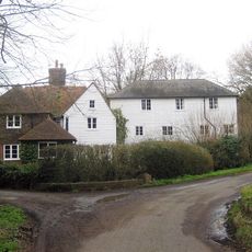
Maplehurst Mill
747 m
Cole Farm
351 m
Sundial About 30 Metres South Of Church Of St Mary
589 m
Oasthouse About 20 Metres South East Of Cherry Tree Farmhouse
282 m
Limberlost
155 m
Frittenden School
594 m
Gould Farmhouse
415 m
Oasthouse And Barn About 15 Metres South Of Manor Farmhouse
738 m
Granary/Outbuilding About 10 Metres East Of Cole Farmhouse
335 m
Bell And Jorrocks Public House
590 m
Well House
606 m
Lychgate And Quadrant Walls, About 40 Metres South Off Church Of St Mary
601 m
Ryecot
593 m
Street Farm Cottage Street Farmhouse
638 m
Wall And Outhouse Attached To Ryecot
574 m
Manor Farmhouse
717 m
Cherry Tree Farmhouse
310 m
Maplehurst Mill House
738 mRecensioni
Ha visitato questo luogo? Tocchi le stelle per valutarlo e condividere la Sua esperienza o foto con la community! Provalo ora! Puoi annullarlo in qualsiasi momento.
Scopri tesori nascosti ad ogni viaggio!
Da piccoli caffè caratteristici a panorami nascosti, fuggi dalla folla e scova i posti che fanno davvero per te. La nostra app ti semplifica tutto: ricerca vocale, filtri furbi, percorsi ottimizzati e dritte autentiche da viaggiatori di tutto il mondo. Scaricala subito per vivere l'avventura sul tuo smartphone!

Un nuovo approccio alla scoperta turistica❞
— Le Figaro
Tutti i luoghi che meritano di essere esplorati❞
— France Info
Un’escursione su misura in pochi clic❞
— 20 Minutes