Chart Place, building in Chart Sutton, Maidstone, Kent, UK
Posizione: Chart Sutton
Coordinate GPS: 51.21582,0.58146
Ultimo aggiornamento: 22 novembre 2025 alle 16:05
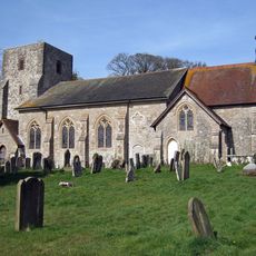
Church of St Michael
67 m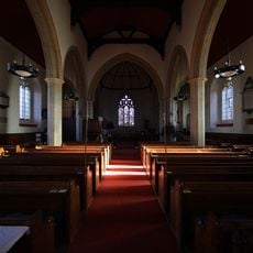
Church of St Mary, Sutton Valence
640 m
Table Tomb About 28 Metres South Of Church Of St Mary
656 m
Table Tomb To Elizabeth Crispe About 25 Metres South Of Church Of St Mary
658 m
Mounting Block About 20 Metres West North West Of Church Of St Michael
36 m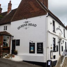
The Queens Head Public House
809 m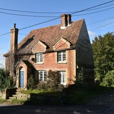
Ivy Cottage
820 m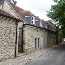
Former Almshouses, Now Part Of Sutton Valence School
910 m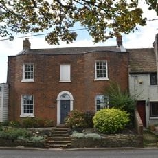
Osborne House
840 m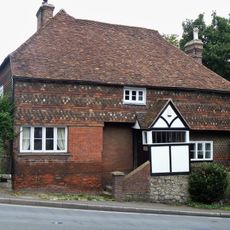
Hillside House
756 m
Manor Farmhouse
697 m
Former Granary About 15 Metres North Of Chart Place Cottages
76 m
Motto Cottages
869 m
Court Farmhouse And Barn
75 m
Table Tomb About 10 Metres South West Of Church Of St Mary
654 m
Sutton Platt Cottage
346 m
Rectory Farmhouse
426 m
Priory House
525 m
Sutton Valence School Block Erected 1910-1914
852 m
Belringham
777 m
Norton Court
689 m
Stable To South Of Rectory Farmhouse
461 m
Ladds Court
774 m
Wentways
754 m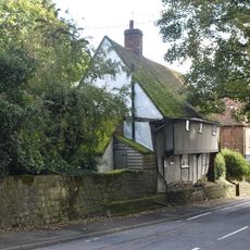
Heaven Cottage
718 m
Appin Mor Old Place
808 m
Barn About 40 Metres South South West Of Park House Farmhouse
439 m
Candy Cottage Townwell Cottage
900 mRecensioni
Ha visitato questo luogo? Tocchi le stelle per valutarlo e condividere la Sua esperienza o foto con la community! Provalo ora! Puoi annullarlo in qualsiasi momento.
Scopri tesori nascosti ad ogni viaggio!
Da piccoli caffè caratteristici a panorami nascosti, fuggi dalla folla e scova i posti che fanno davvero per te. La nostra app ti semplifica tutto: ricerca vocale, filtri furbi, percorsi ottimizzati e dritte autentiche da viaggiatori di tutto il mondo. Scaricala subito per vivere l'avventura sul tuo smartphone!

Un nuovo approccio alla scoperta turistica❞
— Le Figaro
Tutti i luoghi che meritano di essere esplorati❞
— France Info
Un’escursione su misura in pochi clic❞
— 20 Minutes