
Farm Building To East Of Whickham Riding School House
Farm Building To East Of Whickham Riding School House, agricultural structure in Gateshead, Tyne and Wear, UK
Posizione: Gateshead
Coordinate GPS: 54.94574,-1.66358
Ultimo aggiornamento: 15 novembre 2025 alle 11:11
Washing Wells Roman Fort
1.1 km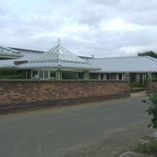
Dunston Hill Hospital
432 m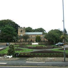
Church of St Mary
677 m
Tomb Of Jane Clasper About 13 Metres North Of Church Of St Mary
697 m
Whickam Park Whickham Park
590 m
Whickham Cottage Hospital
884 m
Park Cottage
622 m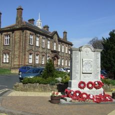
Whickham War Memorial
655 m
Coal mining remains at Dunston Hill
521 m
67, Front Street
1.1 km
Restaurant And House Opposite Number 11
766 m
12 And 14, Front Street
505 m
11 And 13, Front Street
326 m
Whickham Thorns Farmhouse
670 m
Stables North Of Dunston Hill Hospital
392 m
K6 Telephone Kiosk Adjacent To Council Offices
613 m
20, Front Street
700 m
Whickham Lodge And Wing At Right
466 m
69, Front Street
1.1 km
Tomb Of Henry Clasper About 13 Metres North Of Church Of St Mary
694 m
11, Church Chare
759 m
Duston Hill Hospital Outpatients Department
414 m
Oak Villa
284 m
Windmill In King Georges Field (Chase Park) 180 Metres South Of Street
665 m
Dunston War Memorial
1.1 km
Regal Cinema
747 m
Bust Of John English At West Corner Of Church Chare
807 m
Salisbury House
1.1 kmRecensioni
Ha visitato questo luogo? Tocchi le stelle per valutarlo e condividere la Sua esperienza o foto con la community! Provalo ora! Puoi annullarlo in qualsiasi momento.
Scopri tesori nascosti ad ogni viaggio!
Da piccoli caffè caratteristici a panorami nascosti, fuggi dalla folla e scova i posti che fanno davvero per te. La nostra app ti semplifica tutto: ricerca vocale, filtri furbi, percorsi ottimizzati e dritte autentiche da viaggiatori di tutto il mondo. Scaricala subito per vivere l'avventura sul tuo smartphone!

Un nuovo approccio alla scoperta turistica❞
— Le Figaro
Tutti i luoghi che meritano di essere esplorati❞
— France Info
Un’escursione su misura in pochi clic❞
— 20 Minutes