
Former Gner Engine Shed, architectural structure in Darlington, County Durham, UK
Posizione: Darlington
Coordinate GPS: 54.53187,-1.54303
Ultimo aggiornamento: 17 novembre 2025 alle 08:50
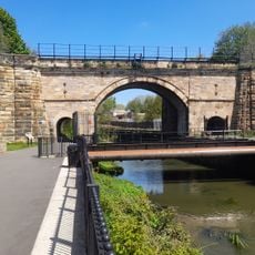
Skerne Bridge
570 m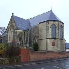
Church of St James
305 m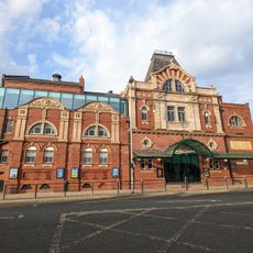
Darlington Hippodrome
884 m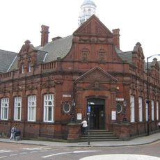
Darlington Library
880 m
3-7, Crown Street
872 m
North Lodge (Education Offices)
728 m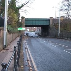
Bridge over North Road, Darlington
734 m
Bandstand To West Of Bowling Green
829 m
1 and 2, Mcnay Street
772 m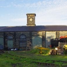
Goods Shed East South East Of North Road Station
764 m
Allan Street, next to St James church
289 m
Cleveland Street, opp. York Street
367 m
138-148 Northgate
716 m
Bridge Over The River Skerne
674 m
Forecourt Railings And Gate Piers To Northgate United Reformed Church
655 m
Front Garden Wall To North Lodge
701 m
Northgate United Reformed Church
642 m
Church of St Hilda
880 m
Numbers 31 To 35 (Odd) (Including Plain Wrought Iron Railings)
709 m
37 And 39, Russell Street
700 m
Bridge Over River Skerne
521 m
Odeon Darlington
619 m
Central School (East Block)
742 m
Central School Annexe
681 m
The former Throstle Nest Bridge, now the Arnold Road Subway
418 m
Route of the Stockton & Darlington Railway trackside sign
47 m
Roman Catholic School-Church of St William of York and St Francis de Sales
457 m
Locomotion
42 mRecensioni
Ha visitato questo luogo? Tocchi le stelle per valutarlo e condividere la Sua esperienza o foto con la community! Provalo ora! Puoi annullarlo in qualsiasi momento.
Scopri tesori nascosti ad ogni viaggio!
Da piccoli caffè caratteristici a panorami nascosti, fuggi dalla folla e scova i posti che fanno davvero per te. La nostra app ti semplifica tutto: ricerca vocale, filtri furbi, percorsi ottimizzati e dritte autentiche da viaggiatori di tutto il mondo. Scaricala subito per vivere l'avventura sul tuo smartphone!

Un nuovo approccio alla scoperta turistica❞
— Le Figaro
Tutti i luoghi che meritano di essere esplorati❞
— France Info
Un’escursione su misura in pochi clic❞
— 20 Minutes