The Red House, house in Sundridge with Ide Hill, Sevenoaks, Kent, UK
Posizione: Sundridge with Ide Hill
Coordinate GPS: 51.27314,0.12602
Ultimo aggiornamento: 20 novembre 2025 alle 19:16
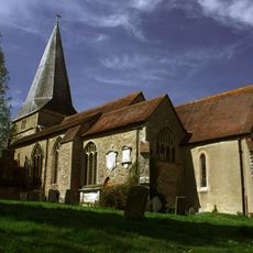
Church of St Mary
258 m
18-22, Church Road
501 m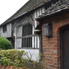
The Old Hall
639 m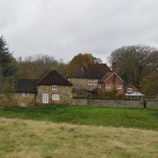
Sundridge Place
221 m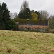
Large Barn To South East Of Sundridge Place With Outbuildings Adjoining
251 m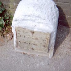
Milestone, Main Road, by No. 134, "Milestone", W of Social Club
562 m
Wall To South Of The Manor House
379 m
Rustic Stone Bridge In Woods To South East Of Brasted Place
589 m
Birchfield Cottage
618 m
The Clock House Stores
534 m
The Manor House
413 m
Chapman's Farmhouse
195 m
94-98, Church Road
124 m
The White House
40 m
1, Church Road
570 m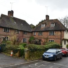
Well Cottage
181 m
Spring Cottage
557 m
Lych Gate To West Of Church Of St Mary
230 m
Aime, Sakers Cottages Forge End, Sakers Cottages Sakers Cottages
509 m
Boundary Wall To West Of Grounds Of The Old Rectory
434 m
199, Main Road
604 m
7-11, Church Road
549 m
The Old Rectory
440 m
Garden Walls To East And North Of Sundridge Place
268 m
118, Main Road
589 m
135 And 137, Main Road
531 m
201 And 203, Main Road
606 m
3 and 5, Church Road
565 mRecensioni
Ha visitato questo luogo? Tocchi le stelle per valutarlo e condividere la Sua esperienza o foto con la community! Provalo ora! Puoi annullarlo in qualsiasi momento.
Scopri tesori nascosti ad ogni viaggio!
Da piccoli caffè caratteristici a panorami nascosti, fuggi dalla folla e scova i posti che fanno davvero per te. La nostra app ti semplifica tutto: ricerca vocale, filtri furbi, percorsi ottimizzati e dritte autentiche da viaggiatori di tutto il mondo. Scaricala subito per vivere l'avventura sul tuo smartphone!

Un nuovo approccio alla scoperta turistica❞
— Le Figaro
Tutti i luoghi che meritano di essere esplorati❞
— France Info
Un’escursione su misura in pochi clic❞
— 20 Minutes