
Brignall Mill House, house in Brignall, County Durham, UK
Posizione: Brignall
Coordinate GPS: 54.49649,-1.92993
Ultimo aggiornamento: 25 novembre 2023 alle 01:42
Brignall Banks
1.7 km
Bowfield Cottage
1.7 km
Scargill Castle
885 m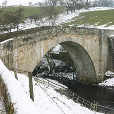
Rutherford Bridge
1.5 km
A cairn and a carved rock on a prominent knoll, south of the road from Barningham to East Hope, 690m WSW of Haythwaite, Barningh
2.4 km
Medieval chapel 350m south east of Castle Farm
1.2 km
Barn And Attached Wheel House To West Of Birk Hall Farmhouse
2.1 km
Prehistoric enclosure 530m and a rubble bank 500m east of Haythwaite in Scale Knoll Allotment, Barningham Moor
2.3 km
Garden Wall To South Of Castle Farmhouse
831 m
Scargill fortified house, medieval settlement and associated field system
825 m
Ring cairn at the northern end of Scale Knoll Allotment, 750m WNW of Haythwaite
2 km
A rock with cups and rings in Scale Knoll Allotment, 790m WSW of Haythwaite, Barningham Moor
2.5 km
A cairn and a carved rock west of Cowclose Gill, in Scale Knoll Allotment, 460m west of Haythwaite, Barningham Moor
2.2 km
A cup marked rock with 13 cups and a groove, on a knoll in Scale Knoll Allotment, 700m north east of Black Hill Gate, Barningham
2.5 km
A cup and groove marked rock, east of Woodclose Gill, 645m north east of Black Hill Gate, Barningham Moor
2.4 km
A carved rock with one cup, at the east side of Woodclose Gill, in Scale Knoll Allotment, 500m north east of Black Hill Gate, Ba
2.5 km
A cairn and a rubble bank in Scale Knoll Allotment, 510m WSW of Haythwaite, Barningham Moor
2.5 km
Prehistoric enclosure on the west side of Scale Knoll Gill, 400m WSW of Haythwaite, Barningham Moor
2.4 km
Anvil House
2.4 km
Cowclose House And Adjacent Byre
2.4 km
Front Garden Walls To Brignall Farmhouse
2.6 km
A rock with three grooves and five cups with rings, in Scale Knoll Allotment, 800m WSW of Haythwaite, Barningham Moor
2.4 km
Ring cairn 350m east of Haythwaite, Barningham Moor
2.5 km
Cairnfield partly enclosed by a bank, on the east side of Woodclose Gill, Scale Knoll Allotment, Barningham Moor, 550m south of
2.2 km
A cairn on a knoll east of Woodclose Gill, in Scale Knoll Allotment, 785m north east of Black Hill Gate
2.4 km
Dent House Farmhouse With Adjacent Outbuilding On West
2.3 km
Foundations And Fragment Of A Chapel
1.2 km
Castle Farmhouse And Byre With Loft To Left
815 mRecensioni
Ha visitato questo luogo? Tocchi le stelle per valutarlo e condividere la Sua esperienza o foto con la community! Provalo ora! Puoi annullarlo in qualsiasi momento.
Scopri tesori nascosti ad ogni viaggio!
Da piccoli caffè caratteristici a panorami nascosti, fuggi dalla folla e scova i posti che fanno davvero per te. La nostra app ti semplifica tutto: ricerca vocale, filtri furbi, percorsi ottimizzati e dritte autentiche da viaggiatori di tutto il mondo. Scaricala subito per vivere l'avventura sul tuo smartphone!

Un nuovo approccio alla scoperta turistica❞
— Le Figaro
Tutti i luoghi che meritano di essere esplorati❞
— France Info
Un’escursione su misura in pochi clic❞
— 20 Minutes