Cranfield Golf Course
Posizione: London Borough of Barking and Dagenham
Coordinate GPS: 51.57694,0.14879
Ultimo aggiornamento: 8 ottobre 2024 alle 01:17
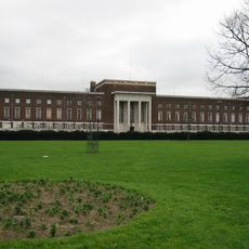
Dagenham Civic Centre
1.8 km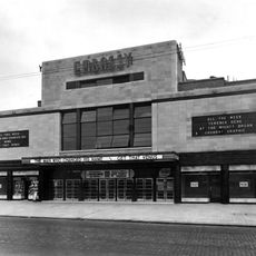
The Embassy Cinema
1.6 km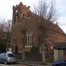
St Chad's Church, Chadwell Heath
1.1 km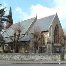
Church of St Andrew
1.9 km
Salem Chapel
1.9 km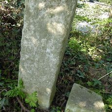
The Marks Stones (On East Side Of Road North Of Eastern Avenue, Set In A Hedge)
966 m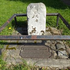
The Havering Stone (On North Side Of The Road At The Former Romford/Dagenham Borough Boundary)
430 m
Water Pump On South Side Of Road
453 m
Anti Aircraft Site At Tq 48738975
1.1 km
Warren Farm Barn
821 m
The Warren Stone (Approximately 250 Yards East Of The Marks Stones)
908 m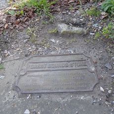
Forest Bounds Stone
571 m
Obelisk On Railway Embankment Approximately 280 Metres East Of Whalebone Bridge
812 m
Furze House Farmhouse
1.8 km
Bms Insurance
2.1 km
Crown Farmhouse
365 m
Granary To North West Of Crown Farmhouse
368 m
Odeon Becontree
1.8 km
Coal Duty Boundary Marker
1.8 km
Cranfield Golf Academy Chadwell Heath (Driving Range)
505 m
Whalebone Lane North
815 m
Coal Duty Boundary Post On South Side Of Road
456 m
The White House
1.6 km
Odeon Chadwell Heath
1.6 km
Vine Cottage
1.9 km
Wellgate Community Farm
2 km
Chadwell Heath Cemetery Chapel With Entrance Gates, Piers And Railings
1.2 km
Vue Romford
2.1 kmRecensioni
Ha visitato questo luogo? Tocchi le stelle per valutarlo e condividere la Sua esperienza o foto con la community! Provalo ora! Puoi annullarlo in qualsiasi momento.
Scopri tesori nascosti ad ogni viaggio!
Da piccoli caffè caratteristici a panorami nascosti, fuggi dalla folla e scova i posti che fanno davvero per te. La nostra app ti semplifica tutto: ricerca vocale, filtri furbi, percorsi ottimizzati e dritte autentiche da viaggiatori di tutto il mondo. Scaricala subito per vivere l'avventura sul tuo smartphone!

Un nuovo approccio alla scoperta turistica❞
— Le Figaro
Tutti i luoghi che meritano di essere esplorati❞
— France Info
Un’escursione su misura in pochi clic❞
— 20 Minutes