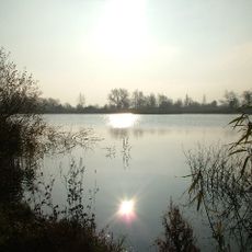
Cotswold Water Park
Posizione: Cotswold
Coordinate GPS: 51.64560,-1.97447
Ultimo aggiornamento: 11 ottobre 2024 alle 05:26
Cotswold Water Park
1.4 km
Clattinger Farm
1 km
Acres Farm Meadow
1.5 km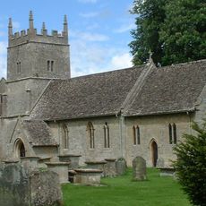
Church of All Saints
1.5 km
Harrison And Two Davis Monuments About 8 Metres South Of South East Corner Of Chancel In Churchyard Of Church Of All Saints
1.4 km
Ferrebec Monument, About 2 Metres South East Of South East Corner Of Chancel In Churchyard Of Church Of All Saints
1.4 km
Unidentified Monument, About 1 Metre East Of North East Corner Of Chancel In Churchyard Of Church Of All Saints
1.5 km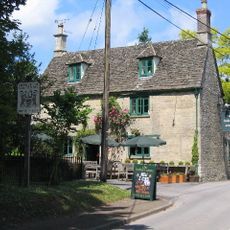
The Bakers Arms
1.3 km
Hales Monument, About 10 Metres South Of South East Tower Buttress In Churchyard Of Church Of All Saints
1.4 km
Unidentified Monument, About 4 Metres South East Of South Porch In Churchyard Of Church Of All Saints
1.4 km
Unidentified Monument, About 8 Metres South East Of South East Corner Of Chancel In Churchyard Of Church Of All Saints
1.4 km
Two Unidentified Monuments, About 21 Metres South Of South East Corner Of Nave Against South Wall Of Churchyard Of Church Of All Saints
1.4 km
Somerford Keynes House
1.4 km
Two Hinton And Two Unidentified Monuments, About 14 Metres South East Of South East Corner Of Chancel In Churchyard Of Church Of All Saints
1.4 km
The Old School House
783 m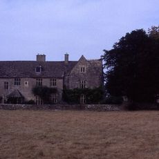
Manor House
1.5 km
Former Stables At Manor House
1.5 km
Dovecote At Manor House
1.5 km
Yew Tree Farmhouse
932 m
Kemble Mill
1.2 km
House Known As Kemble Mill
1.2 km
Water meadow 400m east of Clattinger Farm
821 m
Medieval settlement and associated field system at Clattinger Farm
1.2 km
Kings Cottage And Adjoining Former Coach House And Stables To South And Single Storey Block To West
1.4 km
Group Of Three Monuments, About 6 To 12 Metres South Of South East Corner Of Nave In Churchyard Of Church Of All Saints
1.4 km
Stable Cottage At Dower House Stables At Dower House
1.4 km
Pendle
1.3 km
Croft House
1.2 kmRecensioni
Ha visitato questo luogo? Tocchi le stelle per valutarlo e condividere la Sua esperienza o foto con la community! Provalo ora! Puoi annullarlo in qualsiasi momento.
Scopri tesori nascosti ad ogni viaggio!
Da piccoli caffè caratteristici a panorami nascosti, fuggi dalla folla e scova i posti che fanno davvero per te. La nostra app ti semplifica tutto: ricerca vocale, filtri furbi, percorsi ottimizzati e dritte autentiche da viaggiatori di tutto il mondo. Scaricala subito per vivere l'avventura sul tuo smartphone!

Un nuovo approccio alla scoperta turistica❞
— Le Figaro
Tutti i luoghi che meritano di essere esplorati❞
— France Info
Un’escursione su misura in pochi clic❞
— 20 Minutes