
1 and 2, Carlbury Vale, building in High Coniscliffe, Darlington, County Durham, UK
Posizione: High Coniscliffe
Coordinate GPS: 54.53657,-1.67132
Ultimo aggiornamento: 25 novembre 2023 alle 01:31

Piercebridge Roman Fort
298 m
Ponte romano
67 m
Piercebridge Roman Fort
300 m
Church of St Mary
327 m
George Hotel
298 m
Roman bridge at Piercebridge
225 m
Carlbury Bridge
233 m
Piercebridge Bridge
344 m
The Bridge House
334 m
Milepost South Of Carlbury Hall
237 m
Ivy House
348 m
Round barrow 340m east of Cliffe Hall known as Betty Watson's Hill
583 m
Wall, Gate Piers, Overthrow And Lantern To West Of Church Of St Mary
341 m
Wall With Two Light Traceried Window 40 Metres West Of Carlbury Hall
159 m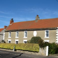
The Old Hall
1.2 km
Medieval Chapel Ruins On Roman Foundations In Rear Garden Of Bath House, Tees View
350 m
2, The Green
376 m
28, The Green
324 m
Cliffe Bank Farmhouse
1.2 km
Smotherlaw round barrow
582 m
Braemar Cottage
1.1 km
Round barrow 190m south east of Cliffe Hall
770 m
Garden Walls And Gate Piers In Front Of Numbers 24 And 25
1.2 km
24 And 25, The Green
1.2 km
Garden Wall And End Piers In Front Of Number 23 (The Old Hall)
1.2 km
29, The Green
333 m
K6 Telephone Kiosk Opposite Old Hall
1.2 km
Wall And Tower To East Of Number 46A
1.3 kmRecensioni
Ha visitato questo luogo? Tocchi le stelle per valutarlo e condividere la Sua esperienza o foto con la community! Provalo ora! Puoi annullarlo in qualsiasi momento.
Scopri tesori nascosti ad ogni viaggio!
Da piccoli caffè caratteristici a panorami nascosti, fuggi dalla folla e scova i posti che fanno davvero per te. La nostra app ti semplifica tutto: ricerca vocale, filtri furbi, percorsi ottimizzati e dritte autentiche da viaggiatori di tutto il mondo. Scaricala subito per vivere l'avventura sul tuo smartphone!

Un nuovo approccio alla scoperta turistica❞
— Le Figaro
Tutti i luoghi che meritano di essere esplorati❞
— France Info
Un’escursione su misura in pochi clic❞
— 20 Minutes