
High Carlbury Farmhouse, farmhouse in High Coniscliffe, Darlington, County Durham, UK
Posizione: High Coniscliffe
Coordinate GPS: 54.55179,-1.67205
Ultimo aggiornamento: 25 novembre 2023 alle 01:31
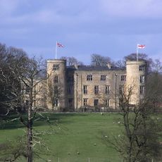
Walworth Castle
1.6 km
Piercebridge Roman Fort
1.7 km
Ponte romano
1.8 km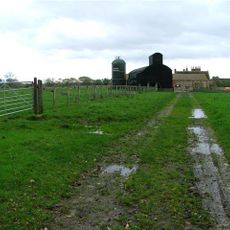
Ulnaby
1.5 km
Piercebridge Roman Fort
1.8 km
Church of St Mary
1.7 km
Carlbury Bridge
1.6 km
Milepost South Of Carlbury Hall
1.7 km
Ivy House
1.6 km
Garden Walls, Farmbuilding And Smithy To North And East Of Ulnaby Hall
1.4 km
28, The Green
1.7 km
Milepost 700 Metres South East Of Junction With New Lane
1 km
Wall, Gate Piers, Overthrow And Lantern To West Of Church Of St Mary
1.7 km
Thompson Headstone 25 Metres South Of Church Of St Mary
1.5 km
Stone Coffin Against South Nave Wall Of Church Of St Mary
1.6 km
Wall With Two Light Traceried Window 40 Metres West Of Carlbury Hall
1.6 km
2, The Green
1.6 km
Deserted medieval village of Ulnaby
1.4 km
Smotherlaw round barrow
1.5 km
Denton Hall
1.6 km
29, The Green
1.7 km
Ulnaby Hall
1.4 km
Garden Walls In Front Of Ulnaby Hall
1.4 km
1 and 2, Carlbury Vale
1.7 km
Glebe House
1.5 km
Front Range Of Farmbuildings And Gin Gang To West Of Piercebridge Grange Farmhouse
1.1 km
Piercebridge Grange Farmhouse And Front Garden Wall, Railings And Gate
1.1 km
Hall Headstone 20 Metres South Of Church Of St Mary
1.5 kmRecensioni
Ha visitato questo luogo? Tocchi le stelle per valutarlo e condividere la Sua esperienza o foto con la community! Provalo ora! Puoi annullarlo in qualsiasi momento.
Scopri tesori nascosti ad ogni viaggio!
Da piccoli caffè caratteristici a panorami nascosti, fuggi dalla folla e scova i posti che fanno davvero per te. La nostra app ti semplifica tutto: ricerca vocale, filtri furbi, percorsi ottimizzati e dritte autentiche da viaggiatori di tutto il mondo. Scaricala subito per vivere l'avventura sul tuo smartphone!

Un nuovo approccio alla scoperta turistica❞
— Le Figaro
Tutti i luoghi che meritano di essere esplorati❞
— France Info
Un’escursione su misura in pochi clic❞
— 20 Minutes