Witness

Accedi al tuo account

AroundUs è una mappa collaborativa di luoghi interessanti, costruita da esploratori curiosi come te. Cresce con ogni recensione, storia e foto che condividi.
Accedi per salvare i tuoi posti preferiti, contribuire con nuovi luoghi e creare percorsi personalizzati.
Continuando, accetti i nostri Termini e Condizioni e la nostra Informativa sulla Privacy
Aggiungi alla collezione
Mappa
Suggerisci una modifica
Condividere

Witness

Posizione: Epsom and Ewell

Creatore: John Merrill

Realizzato in: oak

Creatore: John Merrill

Coordinate GPS: 51.30120,-0.27510

Ultimo aggiornamento: 17 novembre 2025 alle 03:53
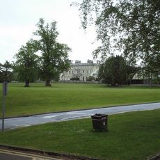
Intorno a questo luogo
Mostra la mappa completa
Ashtead Park
Regno Unito

Ashtead Park

1.1 km
Bridgman Monument Approximately 8 Metres South Of Corner Of Chancel Of Church Of St Giles
Regno Unito

Bridgman Monument Approximately 8 Metres South Of Corner Of Chancel Of Church Of St Giles

1.3 km
Hamelot Monument Approximately 18 Metres South East Of Chancel Of Church Of St Giles
Regno Unito

Hamelot Monument Approximately 18 Metres South East Of Chancel Of Church Of St Giles

1.3 km
Warreners Cottage, Just North Of The Wall, Including Wall Running A Few Yards To North
Regno Unito

Warreners Cottage, Just North Of The Wall, Including Wall Running A Few Yards To North

1.2 km
The Well
Regno Unito

The Well

1.1 km
Two Tomb Chests Approximately 27 Metres South Of Church Of St Giles
Regno Unito

Two Tomb Chests Approximately 27 Metres South Of Church Of St Giles

1.3 km
102, Beaconsfield Road
Regno Unito

102, Beaconsfield Road

1.2 km
Ashtead Park House And Attached Balustrades
Regno Unito

Ashtead Park House And Attached Balustrades

1.1 km
Row Of 7 Headstones And 4 Footstones From Approximately 17 To Approximately 25 Metres South Of Church Of St Giles
Regno Unito

Row Of 7 Headstones And 4 Footstones From Approximately 17 To Approximately 25 Metres South Of Church Of St Giles

1.3 km
Dovecote 10 yards west of Hurst Farm House
Regno Unito

Dovecote 10 yards west of Hurst Farm House

1.3 km
Hurst Farm House
Regno Unito

Hurst Farm House

1.3 km
Walls And Balustrades To Terraced Garden On North Side Of Ashtead Park House
Regno Unito

Walls And Balustrades To Terraced Garden On North Side Of Ashtead Park House

1.1 km
Sundial In Centre Of Forecourt In Front Of South Front Of Ashtead Park House
Regno Unito

Sundial In Centre Of Forecourt In Front Of South Front Of Ashtead Park House

1.1 km
Coal Tax Post At Tq 200 579
Regno Unito

Coal Tax Post At Tq 200 579

769 m
Gate Piers And Gates To Ashtead Park At Juncton Of Farm Lane And Pleasure Pit
Regno Unito

Gate Piers And Gates To Ashtead Park At Juncton Of Farm Lane And Pleasure Pit

1.3 km
Wall Bordering North West And South Sides Of The Warren
Regno Unito

Wall Bordering North West And South Sides Of The Warren

707 m
Wall Along East Part Of North Side Of The Warren Recreation Ground
Regno Unito

Wall Along East Part Of North Side Of The Warren Recreation Ground

1.2 km
Boundary Wall To Woodcote Park Extending From Opposite Pumping Station To Corner With Chalk Pit Road
Regno Unito

Boundary Wall To Woodcote Park Extending From Opposite Pumping Station To Corner With Chalk Pit Road

494 m
Coal Tax Post To South East End
Regno Unito

Coal Tax Post To South East End

1.2 km
Boundary Wall To Woodcote Park To North East Of Land Occupied By Spindles
Regno Unito

Boundary Wall To Woodcote Park To North East Of Land Occupied By Spindles

1.2 km
Coal Tax Post Near Junction With Headley Road
Regno Unito

Coal Tax Post Near Junction With Headley Road

1.2 km
Coal Tax Post To South East Of Langley Bottom Farm
Regno Unito

Coal Tax Post To South East Of Langley Bottom Farm

552 m
Coal Tax Post At Junction With Langley Vale Road
Regno Unito

Coal Tax Post At Junction With Langley Vale Road

326 m
Wellhouse At Woodcote Park
Regno Unito

Wellhouse At Woodcote Park

1.3 km
Balustrade Enclosing Forecourt In Front Of South Front Of Ashtead Park House
Regno Unito

Balustrade Enclosing Forecourt In Front Of South Front Of Ashtead Park House

1.1 km
Stable Block Approximately 100 Metres West Of Ashtead Park House
Regno Unito

Stable Block Approximately 100 Metres West Of Ashtead Park House

1.2 km
Group Of 7 Headstones And 5 Footstones From Approximately 17 To Approximately 25 Metres South Of Church Of St Giles
Regno Unito

Group Of 7 Headstones And 5 Footstones From Approximately 17 To Approximately 25 Metres South Of Church Of St Giles

1.3 km
Hurst Farm
Regno Unito

Hurst Farm

1.3 km
Mostra la mappa completa

Recensioni

Ha visitato questo luogo? Tocchi le stelle per valutarlo e condividere la Sua esperienza o foto con la community! Provalo ora! Puoi annullarlo in qualsiasi momento.

« Witness » è fornito da Around Us (it.aroundus.com). Le immagini e i testi sono tratti dal progetto Wikimedia con licenza Creative Commons. È possibile copiare, distribuire e modificare copie di questa pagina, alle condizioni stabilite dalla licenza, a condizione che questa nota sia chiaramente visibile.

Scopri tesori nascosti ad ogni viaggio!

Da piccoli caffè caratteristici a panorami nascosti, fuggi dalla folla e scova i posti che fanno davvero per te. La nostra app ti semplifica tutto: ricerca vocale, filtri furbi, percorsi ottimizzati e dritte autentiche da viaggiatori di tutto il mondo. Scaricala subito per vivere l'avventura sul tuo smartphone!

Around Us App Screenshot

Un nuovo approccio alla scoperta turistica

Le Figaro

Tutti i luoghi che meritano di essere esplorati

France Info

Un’escursione su misura in pochi clic

20 Minutes