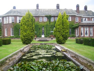
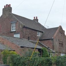
Burton Manor, Residenza signorile a Burton, Inghilterra.
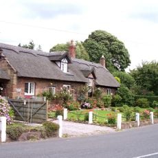
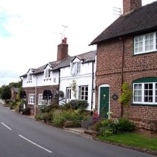
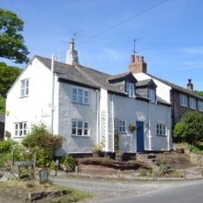
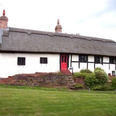
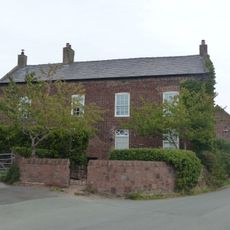
Burton Manor è una casa costruita in arenaria rossa con tetti in ardesia verde e camini ornamentali in pietra e mattoni. L'edificio si trova all'interno di giardini recintati e terreni paesaggistici che formano un parco storico registrato.
La casa fu costruita nel 1805 per Richard Congreve e subì importanti modifiche nel 1904 da parte dell'architetto Charles Nicholson. I lavori furono commissionati da Henry Neville Gladstone, figlio di un ex Primo Ministro.
La tenuta ha funzionato come centro di educazione per adulti, ospitando studenti che venivano ad imparare tra le sue mura. Questo ruolo educativo ha lasciato un segno su come la comunità locale percepiva e utilizzava il luogo.
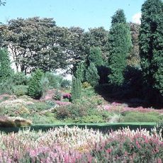
Il giardino recintato è aperto ai visitatori e viene mantenuto da un'organizzazione locale dedicata alla sua conservazione. Puoi esplorare i terreni al tuo ritmo e dovresti prepararti a camminare attraverso diverse sezioni della proprietà.
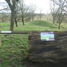
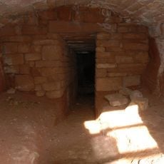
Il terreno contiene una storica ghiacciaia protetta come monumento programmato. Questa struttura sotterranea mostra come le persone conservavano il cibo prima che esistesse la refrigerazione moderna.
Posizione: Cheshire West and Chester
Coordinate GPS: 53.25960,-3.02850
Ultimo aggiornamento: 8 dicembre 2025 alle 22:00
Ness Botanic Gardens
1.7 km
St Michael's Church, Shotwick
3.2 km
Shotwick Hall
3.1 km
Burton Point
1.3 km
St Nicholas' Church, Burton
330 m
Bishop Wilson's House
120 m
Front garden walls and gatepiers at Shotwick Hall
3 km
Tombchest of Robert and Martha Ellison, 10 metres southwest of south corner of tower of Church of St Michael
3.2 km
Rake Farm Cottage
83 m
Plessington Cottage
253 m
L-shaped ranges of farm buildings 60 metres north of Shotwick Hall
3 km
Ice house approximately 75 metres south west of Burton Manor
108 m
Barn End
108 m
Sundial in the churchyard of St Michael
3.2 km
Laburnam Farmhouse And Garden Walls Attached At Front
2.3 km
Footpath Guidepost At Junction Of Pipers Lane Opposite The White House
1.5 km
Group of 18 chest tombs, approximately 2 metres from the southeast corner of Church of St Nicholas
325 m
Tombchest of James Phillips, 2 metres south of the sundial in the Churchyard of St Michael
3.2 km
Former kitchen or bakehouse attached to north east corner of Shotwick Hall
3 km
K6 Telephone Kiosk In Forecourt Of Post Office (Post Office Not Included)
2.3 km
Tombchest of Rev M Reay and 4 children, 8 metres south of south porch of Church of St Michael
3.2 km
Tombchest of John Nevett Bennett, 5 metres west of south porch of St Michael's Church
3.2 km
Tombchest of William Briscoe (died 1723) and others, 4 metres west of priest's door to St Michael's Church
3.2 km
Vicarage Farmhouse
3.2 km
Tombchest of William Briscoe (died 1704) and others, 5 metres southwest of priest's door to St Michael's Church
3.2 km
Footpath Guidepost 5 Metres North Of Top Lodge
1.8 km
Goldstraw Farmhouse And Attached Farm Building To North West
2.2 km
Milestone, Chester High Road, just N of hospital entrance
3.2 kmHa visitato questo luogo? Tocchi le stelle per valutarlo e condividere la Sua esperienza o foto con la community! Provalo ora! Puoi annullarlo in qualsiasi momento.
Scopri tesori nascosti ad ogni viaggio!
Da piccoli caffè caratteristici a panorami nascosti, fuggi dalla folla e scova i posti che fanno davvero per te. La nostra app ti semplifica tutto: ricerca vocale, filtri furbi, percorsi ottimizzati e dritte autentiche da viaggiatori di tutto il mondo. Scaricala subito per vivere l'avventura sul tuo smartphone!
Un nuovo approccio alla scoperta turistica❞
— Le Figaro
Tutti i luoghi che meritano di essere esplorati❞
— France Info
Un’escursione su misura in pochi clic❞
— 20 Minutes